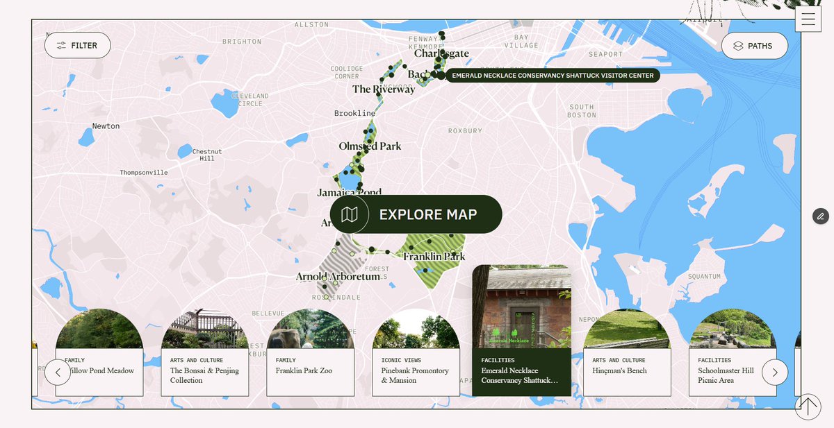
The Emerald Necklace Conservancy released a free interactive map on Wednesday, Sept. 16, giving Brookline residents a new way to explore dozens of landmarks, views and points of interest across the 1,100-acre park system.
The digital tool is available at emeraldnecklace.org/#map and covers all eight parks in the chain stretching seven miles from Boston's Back Bay through Brookline and Jamaica Plain to Franklin Park in Dorchester. The Conservancy announced the map on X, describing it as a new resource for discovering landmarks, iconic views and special sights.
The map is free.
It includes Charlesgate, Back Bay Fens, The Riverway, Olmsted Park, Jamaica Pond, Arnold Arboretum, Arborway and Franklin Park. Olmsted Park and The Riverway both border Brookline neighborhoods, and Jamaica Pond draws walkers and joggers from across the town year-round.
The Conservancy's website said the map lets users learn about each park's history and the nonprofit's restoration work over the past three decades. The organization, which maintains the parks based on landscape architect Frederick Law Olmsted's vision for accessible public green space, keeps them open daily at no charge.
The Boston Sun reported in August that the map was set to launch Aug. 31. The Conservancy's Sept. 16 announcement suggests the tool may have been available for several weeks before the formal public push, though the exact timeline is unclear.
The map arrives as the Conservancy's Journey the Necklace program, a self-guided summer adventure through six parks, continues through Wednesday, Sept. 30. Participants who complete the routes earn a custom bamboo utensil set.
The annual President's Walk of the Emerald Necklace is scheduled for Saturday, Oct. 3, starting at 9 a.m. The six-mile trek runs from Franklin Park to Charlesgate in the Back Bay. Residents can reach the Conservancy at 617-522-2700 or visit the Shattuck Visitor Center at 125 The Fenway, open weekdays 9:30 a.m. to 5 p.m. and weekends 10 a.m. to 4 p.m. through October.